United States Executive Map, Enlarged and Laminated, 69.25" x 48"
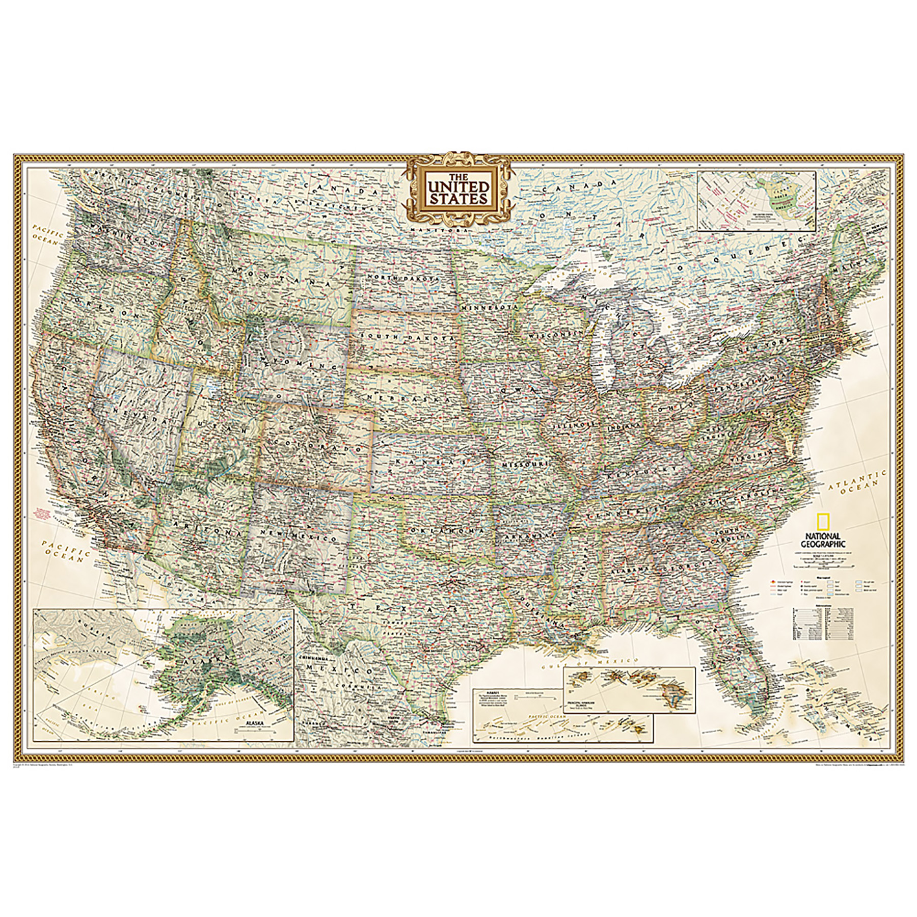
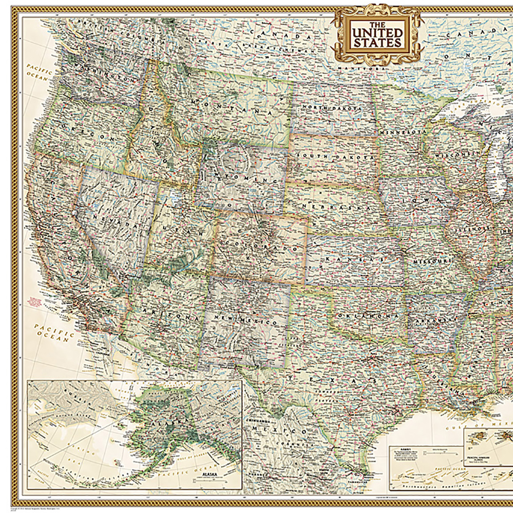
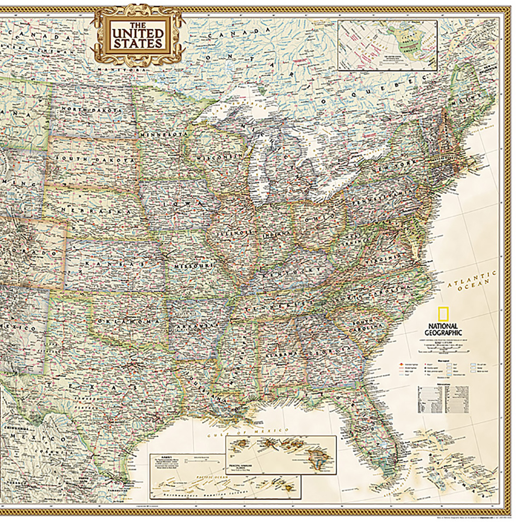
Expertly researched and designed, National Geographic's United States wall map is the standard by which other reference maps of the U.S. are measured. Antique-style "executive" color palette. All 50 states with insets for Hawaiian Islands and Alaska plus inset showing relative size of Alaska. Clearly defined state and country boundaries, cities, islands, national parks, and physical features. Thousands of place names carefully and artfully placed to maintain legibility in heavily populated areas. Background shows mountain ranges and valleys in subtle shaded relief with mountain ranges labeled. Major water bodies including rivers, lakes, gulfs, bays, straits, and ocean bathymetry. Transportation routes including interstate highways, major state routes, airports, waterways, canals, and ferries. Enlarged maps provide an immersive experience in any home or office environment. The exceptional cartography is even easier to appreciate at the larger size. The map is encapsulated in heavy-duty 1.6 mil laminate which makes the paper much more durable and resistant to the swelling and shrinking caused by changes in humidity. Laminated maps can be framed without the need for glass, so the frames can be much lighter and less expensive.
Social Studies : Maps & Map Skills
National Geographic Maps - NGMRE00620117
Quantity Available in warehouse in Semmes, Alabama for Web Orders: 20
(This item is most likely NOT AVAILABLE in our store in St. Louis. To double check or have us find something similar, please call 314-843-2227 with the sku 'NGMRE00620117' and let us know how we can help)
Package Dimensions: Length 53" Width 2" Height 2"
Grade: Grade 9+
Age: 14+ years